Newcastle City Council
Tree preservation zone
There is a problem
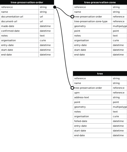
- 1000 entries with tree-preservation-order field must match the reference field in the tree preservation order dataset
Elmfield Road (west)
- reference
- 1981/001.G13
- name
- Elmfield Road (west)
- tree-preservation-order
- 1981/001
- tree-preservation-zone-type
- group
- geometry
- MULTIPOLYGON (((-1.628286 55.000866,-1.628349 55.000862,-1.628478 55.000861,-1.628526 55.000871,-1.628555 55.000879,-1.628681 55.000844,-1.628699 55.000822,-1.628708 55.000800,-1.628797 55.000711,-1.628838 55.000691,-1.628901 55.000671,-1.628795 55.000563,-1.628766 55.000572,-1.628681 55.000489,-1.628646 55.000501,-1.628586 55.000444,-1.628616 55.000433,-1.628349 55.000169,-1.628302 55.000162,-1.627921 55.000294,-1.627960 55.000353,-1.628286 55.000866)))
- point
- POINT (-1.628387 55.000538)
- notes
- These data are update live via a feed to NCC's Tree Managament System, EzyTreev
- entry-date
- 2022-07-01
- start-date
- 1981-01-01
- end-date
How to fix this issue
Your data is missing a tree-preservation-order.
The tree preservation zone guidance explains how to fix the issue:
tree-preservation-order
The reference for the tree preservation order that covers this zone.
How to improve Newcastle City Council’s data
- Fix the errors indicated
- Use the check service to make sure the data meets the standard
- Publish the updated data on the endpoint URL